Batman (aka David Welles) and I set off for Marblemount Thursday evening around 5pm. We stopped at an absolute stink-hole of a diner for dinner on the way. It was in Mount Vernon if I remember right. We decided to eat in the bar for more color and enjoyed an hour of mostly clean place settings, a debate over the lovely lady at the bar by two of the establishment’s gentleman patrons, and an edible meal… eventually. I ordered a cheeseburger with a Gardenburger patty which was delivered by the cook with both the Gardenburger patty and the menu-listed 1/2-pound beef patty between the buns. At that point, what can you do but laugh.
It was getting late when we left the diner and by the time we were past Marblemount and onto the dirt roads night had fallen. After some indecision in the dark about where the trail head actually was, we ended up finding where we needed to be and pitched our tent at a picnic spot near the trail head. We were up at the crack of dawn, broke camp, threw everything but our day-packs in the Batmobile, and set out on the trail.
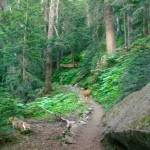
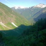
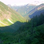
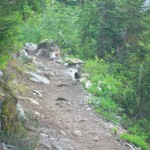
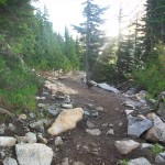
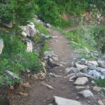
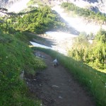
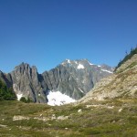
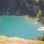
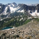
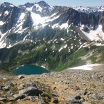
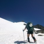
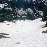
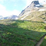
The first part of the climb is your run-of-the-mill wooded trail with switchbacks. It’s about 4 miles and goes up about 2,000 ft. We saw some deer right at the start of the trail and continued to see a opulence of marmots, pheasants, and other critters on the way. After the switchbacks, the forest gives way to Cascade Pass. From here you can continue on to Stehekin if you are up for a seriously long hike or head toward the mountain on the absolutely stunning Sahale Arm. The arm is a long stretch of alpine meadows that gives great views in all directions. It continues on for another 2 miles and 2,000 ft of elevation and tops out at the Sahale Glacier. Along the way you can look down at Doubtful Lake. It still had icebergs floating in it when we went by and had a nice green-blue color.
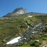
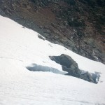
Sahale Glacier is a dormant glacier (no longer moving) so the crevasses are always in the same place year-to-year. Dave and I went unroped easily navigating the obvious crevasses. Below the glacier are a few nice camping spots. I have a desire to take a younger crowd (perhaps my old scout troop) up this climb as a two-day task and make use of the camp. The last slope up the glacier is seriously steep which made it super fun. At about 11:00 we were up the glacier and ready for the final push to the summit.
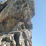
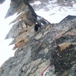
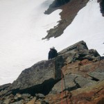
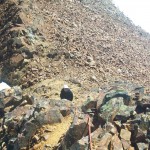
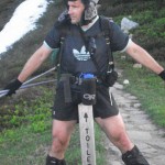
We took lunch and got into our harnesses and prepped for the climb. Most people rate the final climb as a class-4 with one or two low class-5 moves. After doing it, I’d have to agree with them and probably wouldn’t trad-climb the route. As it was, we hadn’t done the climb before and figured to be safe rather than sorry and I led the pitch on a running belay. We had dropped our packs at the base of the summit climb and made short work of the single pitch with no load. The ancient summit marker at the top mislabels the mountain as Boston Mountain which I found very cool. Dave and I snapped some pictures, took the obligatory pee of the summit, and rappelled off the north-west ridge towards the actual Boston.
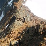
At this point we were starting to get thirsty and realized both of us had left our Nalgenes with our packs back at the top of the glacier. We grabbed some water from drips coming off some melting snow, but it wasn’t much. The terrain on the ridge was really dodgy so we decided to keep with the running belay. While safe, this decision ultimately slowed us down WAY too much to make our Boston bid as we (mostly I) had hoped. By 4:00 we were only half-way there and decided that we needed to turn around if we wanted to leave by daylight. The intense thirst we had at this point (5 hours of labor in the July sun at altitude with only a few drops of water) certainly helped our decision to turn back.
We traveled back laterally around the west face of Sahale and only had to down-climb a few feet to reach our packs. I didn’t like the look of the steep slope for a glissade and neither did Dave. He decided to trek west a ways to a flatter slope and did a seated glissade whilst I chose to basically do a slow-moving arrest down the steep part. On the way down we ran into two marmots having a territory debate. We watched with interest as the skinny marmot beat up the fat marmot and laid claim to the prime position by the trail. His prize was short-lived though as Dave and I continued down the trail seconds later and the victor ran off scared to safer ground. We were running out of daylight so we did our decent at a pretty aggressive pace. It ended up costing me in the end as I tweaked my knee on some loose rock which was quite painful over the last 4 miles or so and ended up costing me again a few weeks later in the Pasaytens. We covered the last mile of the trail in the dark and arrived at the car around 10pm tired and hurting.
Our prize was to find that the delicious Mug root beer can I had left in the car had exploded in the heat and coated the seat, upholstery, and inside of the windshield in sticky, dried-up soda. We cleaned the best we could but only ended up smearing it around on the windshield. At the first gas-station we stopped and bought some Armoral glass cleaning wipes which helped some (it was still pretty gross). When Dave dropped me off at my house I think it took about 30 seconds to fall asleep. In other words: success.
-
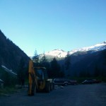
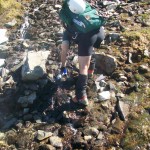
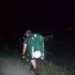
- Too bad they didn’t leave the keys in the glove box
-
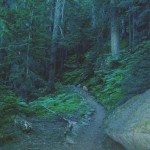
- Some deer heading down the trail
-
- Didn’t want to use the flash and spook them, so the pictures are as steady as my hand
-
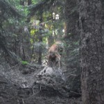
- One last shot before they ran off
-
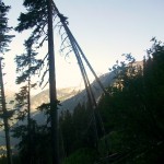
- The switchbacks provided pretty sweet views of the valley as we ascended the boring part of the climb
-
- More pretty views from the forest whenever there was enough of a gap between the trees.
-
- Thankfully we were in the shade during this first half of the climb. It got pretty hot later on.
-
- Can’t argue with the scenery though
-
- Hello mountain turkey
-
- Don’t run, we only want to cook and eat you!
-
- I mean, we are your FRIENDS
-
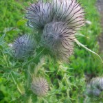
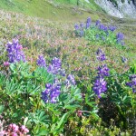
- As we started into the meadows, it was hard to ignore the flowers
-
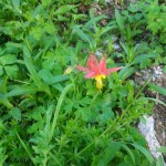
- Small, but beautiful
-
- MARMOTS!
-
- Hey, that flower looks a little different than the other ones
-
- I ended up dumping out my tap water in favor of the far tastier glacial run-off
-
- By this point, I was sweaty enough to want to dunk my head in that
-
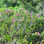
- You can get me a bouquet of alpine flowers any day
-
- The first view of Sahale. That doesn’t look so bad
-
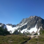
- Mountains and meadows. You’ll hear no complaint from me
-
- That ridge in the foreground looks like a fun scramble
-
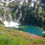
- A first view at Doubtful lake
-
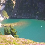
- Loving the color
-
- And loving those icebergs
-
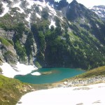
- From further back this time. One of the prettiest alpine lakes I’ve seen.
-
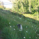
- The Sahale Arm was beautiful meadows as far as the eye could see
-
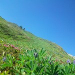
- They just never get old
-
- Hey, lunch is back!
-
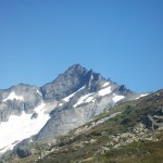
- Forbidden Peak. Another climb I want to do someday
-
- Which would make that Eldorado
-
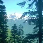
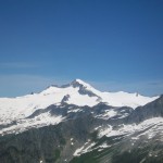
- That’s Baker peaking out in the background
-
- Not sure what that is, but it looks cool
-
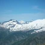
- Mr. Baker again
-
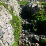
- Cascading streams
-
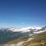
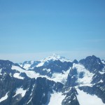
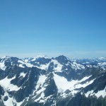
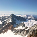
- Torment (far right), Eldorado (middle), and Baker
-
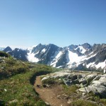
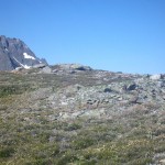
- Our trail
-
- Resupply time
-
- A look back at the sweeping Sahale Arm and Doubtful Lake cradled inside.
-
- Another shot back at the arm
-
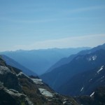
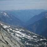
- That giant valley in the distance is Lake Chelan
-
- Dave heading up the glacier
-
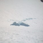
- The easy to spot crevasses
-
- We’ll still give it a wide birth though…
-
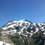
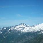
- Glacier Peak and a hint of Mt. Adams
-
- Adams in it’s glory
-
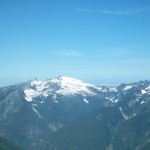
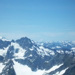
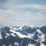
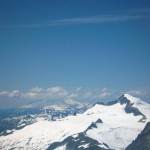
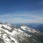
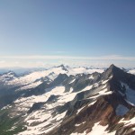
- The Cascades in all their glory
-
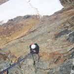
- Wow, that’s some steep snow
-
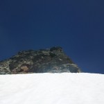
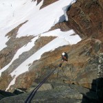
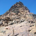
- A rock climb! The summit in sight
-
- A look back down over the glacier and the Sahale Arm. Those hills at the bottom of the glacier are camp sites
-
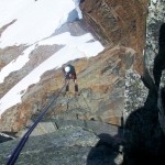
- A class-5 move or two in there
-
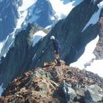
- Master Welles following my lead
-
- Hurry up!
-
- Why, who is that handsome man?
-
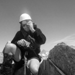
- That’s one bad mother
-
- Oh yes ladies, he’s single
-
- Just a hint of Lake Chelan
-
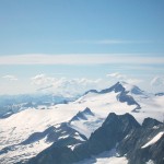
- Glacier Peak standing tall
-
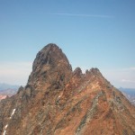
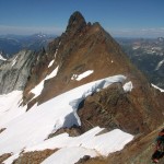
- Boston behind an unnamed peak in the ridge
-
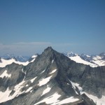
- Forbidden Peak
-
- Eldorado again
-
- Eldorado and Baker covered in mist
-
- Down Eldorado’s west ridge
-
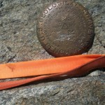
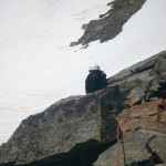
- The mislabeled summit marker
-
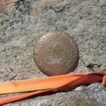
- Another shot
-
- Dave taking a rappel off the summit towards the west ridge
-
- A little further down
-
- I’m gunna have to do this next I suppose
-
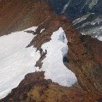
- Boston behind some massive cornices
-
- Wow, you can see the shadow
-
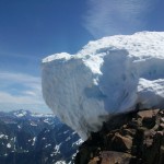
- A closer look at the cornice. Glad we stayed away from the edge
-
- Eastward
-
- Horseshoe peak and Buckner
-
- Too bad that’s just a sub-peak and our climbing it doesn’t count for anything
-
- Looking back at Dave and a field of rocks
-
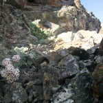
- Some flower found a way to grow on the face of this rock climb
-
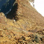
- It was really hard to find a solid place to put rock-pro in all this loose garbage
-
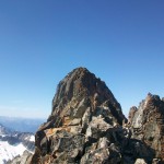
- That peak a few feet in front of me would be the closest I would get to Boston
-
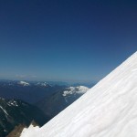
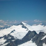
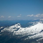
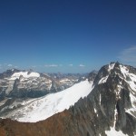
- Forbidden, down the ridge to Torment, with Elderado and Baker in the background
-
- That’s a real nice view of Shuksan
-
- Oh Baker. You are so huge
-
- Don’t do it Dave! (Let me unhook from the rope first)
-
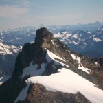
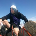
- The Sahale summit from the Sahale-Boston ridge
-
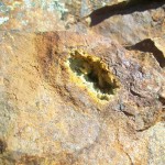
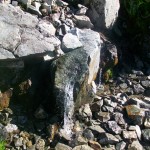
- A cool agate I found in the rock
-
- Why is down-climbing always harder
-
- One last look back at Sahale and it’s wonderful meadows
-
- I told you you could walk to Stehekin
-
- I imagine it’d be quite the round-trip though
-
- Words do this no justice
-
- Finally back to the parking lot. Huzzah!
Comments are closed